 Freshwater flows are important in shaping the physical, chemical and biological characteristics of our coastal waterways. A change in the natural timing and volumes of freshwater entering coastal waterways can be caused by damning, draining of wetlands and billabongs, episodic events and urbanisation, and these can lead to a range of environmental and geomorphic changes.
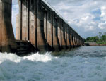
View a conceptual model of potential causes of a change to freshwater flow regime and the condition responses observed as a result of this change.
Potential indicators
There are a number of causes and symptoms related to this stressor. The following indicators are recommended for the stressor ‘Freshwater flow regime’:
Pressure indicators
Indicators of altered freshwater flow regime sources:
- Percentage of median annual flow impounded and extracted
- Impoundment density
- Percentage catchment area covered by artificial waterbodies
Indicators of direct pressure:
- None
Vulnerability indicators
- None
Condition indicators
Physical-chemical condition indicators:
- None
Biological condition indicators:
- None
| Possible causes | Possible symptoms |
| The actions/events/situations that might induce this stress: | The actions/events/situations that might arise from a change to the stressor:
|
Fact sheets on background science and economics
Other information on changed freshwater flow regime
International
Global Environment Monitoring System (GEMStat) is designed to share surface and ground water quality data sets collected from the GEMS/Water Global Network, including over 1,400 stations, two million records, and over 100 parameters.
The Global Runoff Data Centre is the digital world-wide repository of discharge data and associated metadata.
Australia
Australian Natural Resources Atlas. One of the key information delivery mechanisms for the National Land and Water Resources Audit. Search the Australian Natural Resource Atlas for information about surface water quality monitoring programs (including turbidity measurements) in Australia.
Australian Bureau of Agricultural and Resource Economics and Sciences.You can search for metadata (data about data) here.
Current rainfall and river observations. The Bureau of Meteorology provides a map displays data from Bureau stations, and data made available to the Bureau by other agencies.
Simple Estuarine Response Model II (SERM) website contains summary statistics of coupled biological – physical estuarine models as applied to over 700 Australian estuaries. The results of these simulations, along with the original ‘generic’ SERM simulations, can be accessed interactively using the SERM II interface.
New South Wales
Manly Hydraulics Laboratory (MHL).This site provides near real time rainfall and river level data from throughout the Macleay River catchment.
Waterinfo. The NSW Department of Infrastructure, Planning and Natural Resources has over 200 datasets of water quality results from discrete samples. This page provides a list of stations with links to discrete water quality data available for each station. Data is updated weekdays overnight.
Northern Territory
Reports for all telemetered gauging stations. The Natural Systems Division of DPI operates and maintains a network of telemetered gauging stations primarily for the purpose of providing flood forecasting advice. These gauging stations are connected to the telephone network and provide “near-real-time” river heights and rainfall.
Queensland
Department of Natural Resources and Mines. Data on the ambient quantity and quality of the State’s freshwater resources in streams and aquifers is available to the public in digital format under a range of fee and access arrangements.
Waterwatch Gold Coast. This site provides some water flow data from the Waterwatch program from a number of creeks in the Gold Coast Region.
Watershed. This web site provides access to gauging station information, streamflow data summaries and chemical analyses of water samples from the surface water data archive.
South Australia
Surface Water Data. The Surface Water Archive contains rainfall, water level, streamflow, and salinity data collected from a network of surfacewater monitoring sites located throughout South Australia.
Tasmania
Water Information Resources & Electronic Data (W.I.R.E.D) is a joint State and Federally funded system providing on-line access to a range of water information products including water management policies, current river levels and flows, catchment reports, and data summaries for individual sampling/flow sites.
Flood data books. Flood Data Books are a new concept in floodplain management in Tasmania. The books are a collation of existing information on rural floods and their extent.
Victoria
Rainfall and River Level Data. On this page you will find the latest data from about 160 of Melbourne Water’s field monitoring devices that transmit rainfall and water level readings.
Status of Water Resources and Supplies. This is a Monthly Report on the status of rainfall, streamflows and groundwater around Victoria, the status of urban and rural water supplies, and the latest rainfall forecast from the Bureau of Meteorology. Reports, based on the end of the month, are updated during the following month.
Water Measurement Information System. This site combines data from a number of community and scientific based monitoring programs into one easily accessible resource.
Western Australia
River Monitoring Stations. This interactive map page provides summary data and links to graphical presentations of river levels and some additional parameters including rainfall from selected telemetered sites throughout Western Australia.
Models
Australia
The Catchment modelling toolkit, developed by the CRC for Catchment Hydrology, is a repository of hydrologic modelling software intended to improve the efficiency and standard of catchment modelling. Information about the models and how to access them can be obtained from this site. This site also provides information on how to choose an appropriate model.
The Rainfall Runoff Library (RRL) is designed to simulate catchment runoff by using daily rainfall and evapotranspiration data. The models may be applied to catchments from 10 km 2 to 10,000 km 2 on a daily time step. The models are typically used to fill gaps and extend streamflow records.
IHACRES stands for Identification of unit Hydrographs And Component flows from Rainfall, Evaporation and Streamflow data . IHACRES is a catchment-scale rainfall-streamflow modelling methodology whose purpose is to characterise the dynamic relationship between rainfall and streamflow, using rainfall and temperature (or potential evaporation) data, and to predict streamflow.
RORB software for runoff routing RORB Version 5 is a general runoff and streamflow routing program used to calculate flood hydrographs from rainfall and other channel inputs. It subtracts losses from rainfall to produce rainfall-excess and routes this through catchment storage to produce the hydrograph. It can also be used to design retarding basins and to route floods through channel networks.
Simple Estuarine Response Model (SERM) is a coupled biological-physical model of estuarine response in Australian estuaries.
UrbSim simulates the rainfall and runoff processes from an urban catchment. The model can also simulate flow through ponds or basins located within the catchment.
International
USGS Hydrologic and Geochemical Models Software and related material (data and documentation) are made available by the U.S. Geological Survey (USGS) to be used in the public interest and the advancement of science.
Scientific Software Group – Models The Scientific Software Group have developed environmental and water resource software. You can search for products based on their usefulness to a specific environmental discipline.

