 The health of coastal waterways depends on the conservation of a diversity of coastal habitats that provide shelter, food, breeding grounds, nursery areas and migratory corridors for marine life, and that store water, buffer water quality and resists storm-related erosion. Wetland loss or degradation limits the amount of habitat that can support healthy populations of marine organisms and other wildlife.
View a conceptual model of potential causes of habitat removal/disturbance and the condition responses observed as a result of this change.
Potential indicators
There are a number of causes and symptoms related to this stressor. The following indicators are recommended for the stressor ‘Habitat removal and disturbance’ :
Pressure indicators
Indicators of habitat removal/disturbance sources:
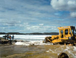
- Dredging activity in river system
- Number of ‘marine’ aquaculture facilities present
Indicators of direct pressure:
- Percentage of estuarine ‘shoreline’ length modified
- Percentage of estuarine ‘background habitat’ length modified
Vulnerability indicators
- None
Condition indicators
Physical-chemical condition indicators:
- None
Biological condition indicators:
| Possible causes | Possible symptoms |
| The actions/events/situations that might induce this stress: | The actions/events/situations that might arise from a change to the stressor:
|
Fact sheets on background science and economics
- Loss of coastal wetland habitat
- Economic consequences of declining biodiversity
- Mangrove areas
- Saltmarsh areas
- Seagrass areas
- Beach and Dune
- Economic consequences of mangrove removal
Other information on habitat removal and disturbance
Australia
Australian Natural Resources Atlas (ANRA) is a network of Australian Government and State/Territory nodes using a variety of interactive mapping tools to provide information about the Australian coastal environment. Also one of the key information delivery mechanisms for the National Land and Water Resources Audit.
Australian Natural Resources Data Library. You can search for metadata (data about data) here.
Integrated Vegetation Online. The Integrated Vegetation dataset provides one source for major vegetation cover types Australia. Information on vegetation includes native forests and grasslands and non-native vegetation.
Estuary Condition Assessments. Choose your estuary from the list. If available, you can download an estuary condition assessment for the estuary, which provides information on critical habitat loss, habitat clearing and a habitat condition index for your chosen estuary.
Simple Estuarine Response Model II (SERM) website contains summary statistics of coupled biological – physical estuarine models as applied to over 700 Australian estuaries. The results of these simulations, along with the original ‘generic’ SERM simulations, can be accessed interactively using the SERM II interface.
New South Wales
New South Wales Natural Resource Atlas. The Natural Resource Atlas is the New South Wales portal to maps and data for environmental management, planning, research and education. Using the NRAtlas you can browse across a range of environmental themes and create your own maps.
Queensland
The Central Queensland Regional Information System (CQRIS) aims to provide access to accurate and timely information of an economic, social, geospatial and/or demographic nature, focusing on the Central Queensland region.
The Coastal Habitat Resources Information System (CHRIS) is a resource centre for Queensland coastal fish habitat, fisheries resources and environmental datasets (layers) developed by the Department of Primary Industries and Fisheries (DPI&F) and other agencies. The integration of these layers in CHRIS facilitates monitoring of the condition and trend of coastal fisheries habitats.
Seagrass depth range and distribution. The EHMP website has information on seagrass depth range and distribution in Moreton Bay, southern Queensland.
Victoria
Catchment Indicators Online. Provides current information about the management and changing condition of Victoria’s land and water resources.
Interactive Maps. Available Interactive Maps that may provide habitat information are Biodiversity Interactive Map; Catchment and Water Mapper; Marine Map — Victoria; Victorian Forest Resources.

