The coastal indicator knowledge and information system is an information source and education tool for managers, students, researchers and policy makers with an interest in the coastal zone. It consists of a series of fact sheets that provide background scientific information on measures that are commonly thought of or used as indicators. These “indicators” are described in terms of:
- what they are;
- what causes them to change;
- their significance;
- considerations for their measurement and interpretation;
- existing information and data; and
- key questions and further research needs.
The indicator fact sheets are linked to other coastal fact sheets (including those on human pressure indicators, coastal issues and economic considerations) and to conceptual models of estuarine function . In this way, we try to convey the complexity of the various measures, and where possible, their interconnectedness and the coastal geomorphic settings where they are best applied.
Coastal issues

Declining water quality

Climate change

Habitat/species alterations

Economic values & consequences
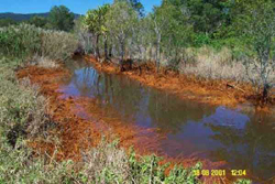
- Economic consequences of acid sulfate soils
- Economic consequences of algal blooms
- Economic consequences of declining biodiversity
- Economic consequences of mangrove removal
- Economic consequences of marine pest invasions
- Economic contribution of recreational fisheries
- Economic value of estuarine commercial fisheries
- Human-Made capital located in estuaries
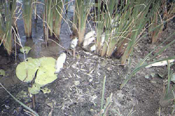
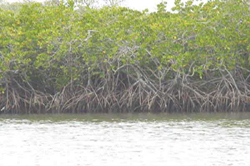
Biophysical indicators

Water quality

Sediment quality
Habitat extent & quality

Biotic indicators
Pressure indicators

Agricultural
Industrial

Urban
Catchment condition
Coastal management indicators

Coastal management indicators


What are environmental indicators?
For the purposes of State of the Environment Reporting , Environmental indicators are physical, chemical, biological or socio-economic measures that best represent key elements of a complex ecosystem or environmental issue. These indicators are thought to have meaning beyond the measures they represent and their trends are expected to yield valuable information about important aspects of the environment. In the context of Natural Resource Management (NRM), indicators are the medium through which one converts qualitative environmental values (EV’s) and management goals into measurable water quality objectives.
Types of indicators?
Indicators are usually classified into different groups or types. In the current module, we use 3 broad groupings of indicators: biophysical indicators, human pressure indicators and coastal management indicators. The biophysical indicators are then further sub-divided into five types: water quality indicators, sediment quality indicators, habitat extent and quality indicators, biotic indicators and ecosystem integrity indicators. The human pressure indicators are also further divided into the following sub-headings: agriculture, industry, urban and catchment condition. NRM recognises three broad categories of indicators: in-stream pressure/stress indicators; value/use indicators; and causal pressure indicators. Brief descriptions of these different indicator types are provided below, and this terminology is maintained in our Environmental ManagementModule to facilitate its use by regional NRM bodies.
In-stream pressure/stress indicators
Water quality management has traditionally relied on water quality parameters (i.e. physical and chemical properties of the water). In NRM circles, these parameters are sometimes referred to as “in-stream pressure/stress indicators.” Implicit in the use of in-stream pressure/stress indicators for NRM is the assumption that there is a known relationship between the pressure/stress indicator and the impact on the EV or management goal. There are many different types of in-stream pressures/stresses that can affect ecosystems . However, these various measures in isolation are unlikely to provide a reliable assessment of ecosystem health. Some examples of in-stream pressure/stress indicators and the relevant EV are provided below:
| Environmental Value | In-stream pressure/stressor indicator |
|---|---|
| Recreation | Faecal coliforms |
| Irrigation | Salinity |
| Aquatic ecosystems | Toxicants |
Value/use indicators
Value/use indicators are most commonly applied to assessment of ecosystem health. These indicators directly measure impacts on environmental values. Examples of value/use indicators are provided below:
| Environmental Value | Value/use indicator |
|---|---|
| Primary recreation | human illness at swimming locations |
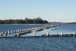
| Aquaculture | survival of aquaculture species |
| Aquatic ecosystems (protection of seagrass) | extent of seagrass |
| Aquatic ecosystems (Protection of stream ecosystems) | Macro-invertebrate diversity |
Value/use indicators can be applied to ‘human’ EVs. However, the quantitative relationships between pressures/stressors and human use values are relatively well described so that it is often cheaper to measure in-stream pressure/stressor indicators. For example, the undertaking of epidemiological studies of human illness rates at beaches is difficult, costly and can yield equivocal results.
Causal pressure indicators
Causal pressures are essentially the driving forces behind the in-stream pressures/stresses. Human-related activities probably drive most modern-day changes in ecosystems. However, natural climate change and disasters also constitute causal pressures or ecosystem forcing functions. NRM recognises five main casual pressures , and a plethora of direct and indirect pressure indicators. For example, in the context of coastal eutrophication , a direct pressure indicator may include the total diffuse nutrient load entering a coastal waterway , whereas the percentage agricultural land in the catchment is an example of an indirect pressure indicator. Causal pressure indicators are seldom used in water quality management strategies . This is due to the perception that the relationships between the causal pressures and condition of EV’s are less well understood than the relationships between in-stream pressures/stressors and condition of EV’s. However, some causal pressure indicators are relatively cheap and easy to measure, and they directly target causes rather effects. It is thus generally agreed that pressure indicators are worth developing further.
Selection of indicators
Selection of indicators is a key step in deriving water quality objectives and designing monitoring programs . It requires an understanding of ecosystem function, which is best achieved through a combination of traditional and advanced environmental studies and state-of-the-art numerical modelling. In the absence of such investigations and applications, NRM often relies on a conceptual approach to selecting indicatorswhereby casual pressures, stresses/in-stream pressures and ecosystem responses are expressed as pictorial hypotheses in the format of conceptual models: e.g. land clearing (a causal pressure) leads to increased sediment loads in rivers (a stress) and elevated turbidity levels and seagrasses loss (responses) in the receiving water body. As a general rule, indicators can be developed for each component in a cascade of interactions. In the above example, the following indicators may be suggested: % native vegetation cleared (indirect pressure indicator), end of river basin sediment loads (direct pressure indicator), turbidity levels (in-stream pressure indicator) and percent seagrass area (a value/use indicator). Detailed indicator development is most often undertaken in the context of development of monitoring programs, rather than the context of objective-setting. Fortunately, the process of actually developing indicators is identical in both cases. Thus indicators developed through monitoring projects are nearly always suitable for objective-setting.
Some precautions
Monitoring of biological, chemical and physical variables can potentially indicate important changes in coastal systems. However, there are some limitations and these should be considered in indicator-related applications:
- there can be a major gap between indicating change and determining cause and effect;
- many indicators have not been validated (i.e. rigorously tested to see if they are telling us what we think they are telling us);
- misleading or erroneous conclusions can be drawn when interpretations based on indicators become overly-simplified; and
- the monitoring of indicators is not a substitute for a comprehensive research program.
How to use this indicator module
The coastal issue discussion sheets and indicator fact sheets can be directly accessed using the tool bar in the left hand margin. The indicator fact sheets and issue discussion sheets are accessed via drop down menus by clicking on the headings for Issues, Economic Values and Consequences, Biophysical Indicators, Human Pressure Indicators and Coastal Management Indicators. The biophysical indicators and human pressure indicators are further divided into sub-groupings.
How to reference
The Coastal Indicator Knowledge and Information System was developed at Geoscience Australia in collaboration with the University of Queensland and Cooperative Research Centre for Coastal Zone, Estuary & Waterway Management, and integrates contributions from more than 70 researchers and coastal managers. The information found on this site may be used for public education material. Detailed reference lists are provided on most sheets and we encourage users to consult this literature and use it for citation purposes with regards to specific processes, studies or applications. General references to Coastal Indicator Knowledge and Information System as a resource and education tool can be made according to one of the following:
For biophysical indicators:
OzEstuaries , 2003. Coastal Indicator Knowledge and Information System I: Biophysical Indicators. [Web document]. Canberra : Geoscience Australia . www.ozestuaries.org/indicators (Accessed day-month-year).
For socioeconomic concerns and values:
Robinson, J. and Cully, T. (OzEstuaries) 2003. Coastal Indicator Knowledge and Information System II: Socioeconomic Concerns and Values. [Web document]. Canberra : Geoscience Australia . www.ozestuaries.org/indicators (Accessed day-month-year).
For authored fact sheets (excluding socioeconomic concerns and values):
Author (example: Chaefer, C.), 2003. Title (Example: Shorebird Counts). In: OzEstuaries Coastal Indicator Knowledge and Information System I: Biophysical Indicators. [Web document]. Canberra : Geoscience Australia . www.ozestuaries.org/indicators (Accessed day-month-year).

